AWARDEE OF EARTH SCIENCES PRIZE
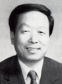
LI DEREN
Abstract
Prof. Li Deren (Deren Li), scientist in photogrammetry and remote sensing, comes from Dantu of Zhenjiang, Jiangshu Province. As an important figure and active member of the scientific community of China, Prof. Li enjoys dual membership of both the Chinese Academy of Sciences and the Chinese Academy of Engineering. He is a “National Level Young and Middle-aged Expert with Outstanding Contribution", member of the Euro-Asia International Academy of Sciences, member of the National Committee of the Chinese People's Political Consultative Conference (CPPCC). At present, he is President, professor and PhD supervisor of Wuhan Technical University of Surveying and Mapping (WTUSM), President of the Chinese Society of Geodesy, Photogrammetry and Cartography, Vice President of Hubei Association for Science and Technology (HAST), Director of the National Laboratory for Information Engineering in Surveying, Mapping and Remote Sensing at WTUSM.
In the 1980s, Prof. Li Deren was mainly engaged in the studies of observation errors and processing methods. During his studies in Germany since 1982, Li Deren proposed a new iteration weighted method for gross error location based on a posterior variance estimation, which has since been named “Deren Li Method". In 1985, he completed theoretical research in the separability of model errors, which advanced the reliability theory of Dutch scientists to the separability phase. His theory has “scientifically solved a hundred-year-baffling problem in geodetic science". The result of this study received the 1988 Best Paper Award of the German Society for Photogrammetry and Remote Sensing, and Hansa Luftbild Award.
In the 1990s, Prof. Li Deren has concentrated on the research and education in spatial information science and technology represented by remote sensing (RS), global positioning systems (GPS) and geographic information systems (GIS). He applies himself diligently to the industrialization of high and new technologies. He has made unique and original contribution in the areas of theories and methods for high precision photogrammetric positioning, GPS aerotriangulation, analysis and processing of SPOT imagery, mathematical morphology and its application in spatial databases, theories of object-oriented GIS, image understanding and automatic photointerpretation, multi-media communication and mobile mapping systems, etc. The research findings have promoted the progress of the technology directly and are being turned into products.
Prof. Li Deren, who has successfully supervised the studies of over 50 MSc candidates and over 60 PhD candidates, has published over 200 papers and 6 books. He has won more than ten of national and ministerial level prizes, such as The Sci-tech Progress Award, National Excellent Textbook Award, Award of the Excellent Educational Achievements, etc.